By importing point cloud data to SketchUp, you’re able to create very accurate 3D models. Use the plug-in found in SketchUp Studio to import point clouds created in Trimble RealWorks, other Trimble software, or from virtually any third-party software using standard file formats like LAS and E57.
Designed with usability in mind, the point cloud plug-in makes it easy for you to create 3D models from point clouds. Simply import your data, snap on, and your model is ready.
What is Point-Cloud Data?
Point clouds are a collection of points in a three-dimensional coordinate system, where each point represents a specific position. These points collectively create a detailed and accurate representation of the surfaces of objects and environments. The points in a point cloud are often obtained through 3D scanning technologies like LiDAR (Light Detection and Ranging) or photogrammetry.
The data is generated by capturing the coordinates of points using laser beams, sensors, or cameras that measure the distance to the subject. Collectively, these form a 3D representation of the scanned area.
How Do I Create Point Cloud Data?
Creating point cloud data typically involves using specialised equipment or techniques for 3D scanning. Here are some common methods:
LiDAR (Light Detection and Ranging):
- LiDAR sensors emit laser beams and measure the time it takes for the laser to bounce back from surfaces.
- Airborne LiDAR is used for large-scale terrain mapping, while ground-based LiDAR is suitable for smaller areas.
Photogrammetry:
- Involves capturing multiple images of an object or area from different angles and using software to analyse the overlapping features to create a 3D model.
- Requires high-resolution cameras.
- Often used for creating point clouds of objects or landscapes from photographs.
Structured Light Scanning:
- Involves projecting a known pattern of light onto an object and using cameras to capture how the pattern deforms on the surfaces.
- Requires projectors and cameras.
- Common in industrial applications for scanning objects with complex shapes.
Time-of-Flight Cameras:
- Cameras that measure the time it takes for light to travel to an object and back to determine the distance.
- Can be used for smaller-scale 3D scanning.
Mobile LiDAR Scanning:
- LiDAR sensors mounted on vehicles or handheld devices.
- Commonly used for mapping urban environments, roads, and infrastructure.
3D Laser Scanning:
- Handheld or tripod-mounted laser scanners.
- Ideal for scanning smaller objects or spaces with high precision.
It’s important to choose the method that best suits your specific application, considering factors like the size of the area to be scanned, the level of detail required, and the equipment available.
You can find some examples to practice with here >
Who Might Use Point Cloud Data?
Surveying and Mapping: Point cloud data is used in land surveying and mapping to create highly detailed representations of landscapes, buildings, and infrastructure.
3D Modeling and Visualisation: Used in creating realistic 3D models of physical spaces or objects for various applications like architecture, urban planning, and virtual reality.
Reverse Engineering: Engineers and designers use point cloud data to recreate and understand the structure and geometry of existing objects, aiding in the reverse engineering process.
Environmental Monitoring: Point clouds can be employed to monitor changes in the environment, such as assessing the topography of a region, or tracking changes in vegetation.
Augmented Reality (AR) and Virtual Reality (VR): Point clouds contribute to immersive AR and VR experiences by providing realistic spatial information for virtual environments.
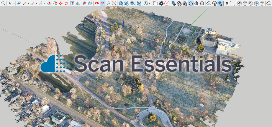
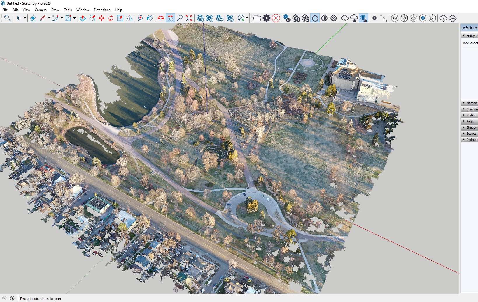
Moving Point-Clouds to SketchUp Studio with Scan Essentials
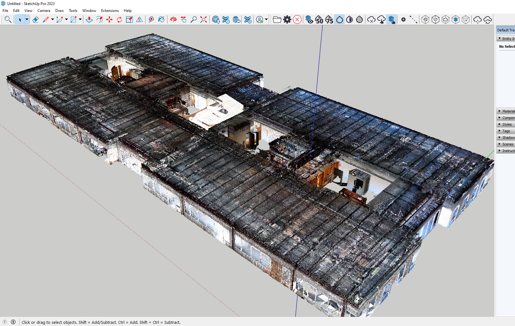
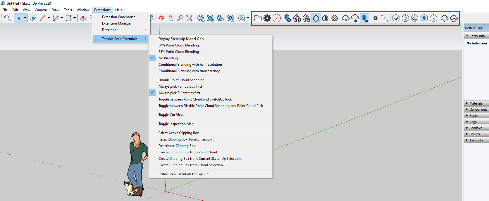
If you have SketchUp Studio, you’ll find Trimble Scan Essentials listed under the Extensions menu. You may also see the tools in the ribbon at the top.
Start by importing your data. Click the folder icon and locate your file. If you import it but can’t see it, try using the Zoom Extents tool as it may have loaded out of view.
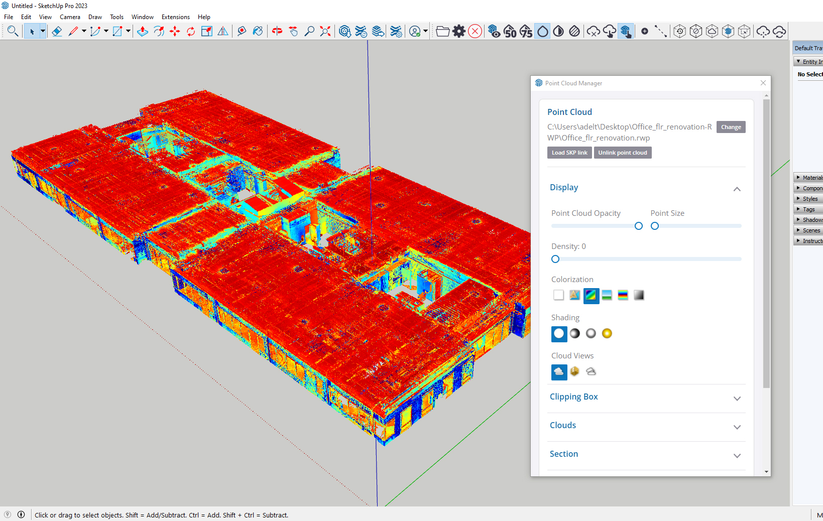
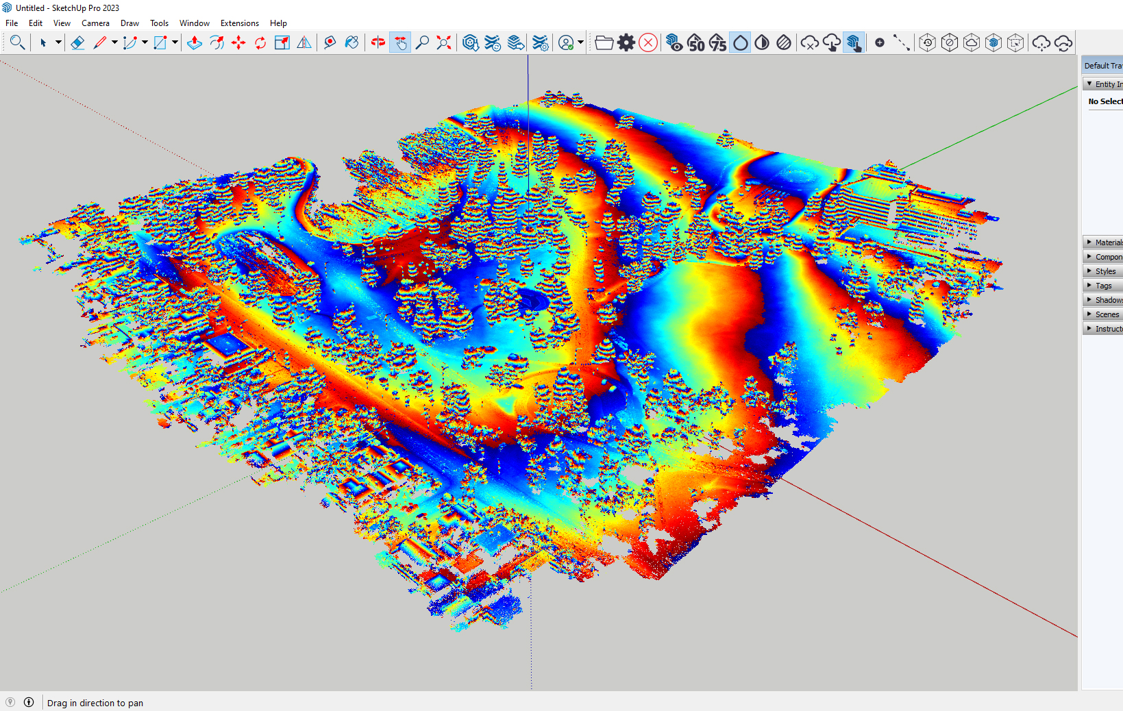
The Point Cloud Manager is there is handle your data. Select the best colour for your needs from white, station colour, colour-coded intensity/elevation, true colour, or greyscale.
You can also use blending types ranging from off, to full, then also conditional so you can create 3D models around the data with clarity.
Use the Inspection Tool to compare your model against the cloud data, clipping boxes to zoom in and focus on specific sections, create section views, work in 2D with LayOut, as well as add PLY files from LiDAR sensors.
Once you have your point cloud data how you want it, use native SketchUp tools to snap on points when creating 3D models.
Ground Mesh in Scan Essentials
In May 2024, SketchUp added a new ground mesh tool to Scan Essentials. This lets you quickly turn 3D point cloud scans into quad-face-based terrain mesh. From here, you can edit and manipulate this in SketchUp.
There are three ground mesh options:
- Fit Cloud – Create a mesh over existing ground data and fill in any holes.
- Rectangular – Create a mesh in a rectangular area.
- Bounded – Use a face in your SketchUp model to create a mesh in a specific area.
You can also use the “Add Detail” tool to increase the resolution of selected faces or you can use the “Make Solid” tool to turn the mesh into a Sketchup Solid.
Buying Scan Essentials
Scan Essentials is included with SketchUp Studio (currently Windows only) and is available to buy at CAD Software Direct.